The Newmarket Road Conservation Area
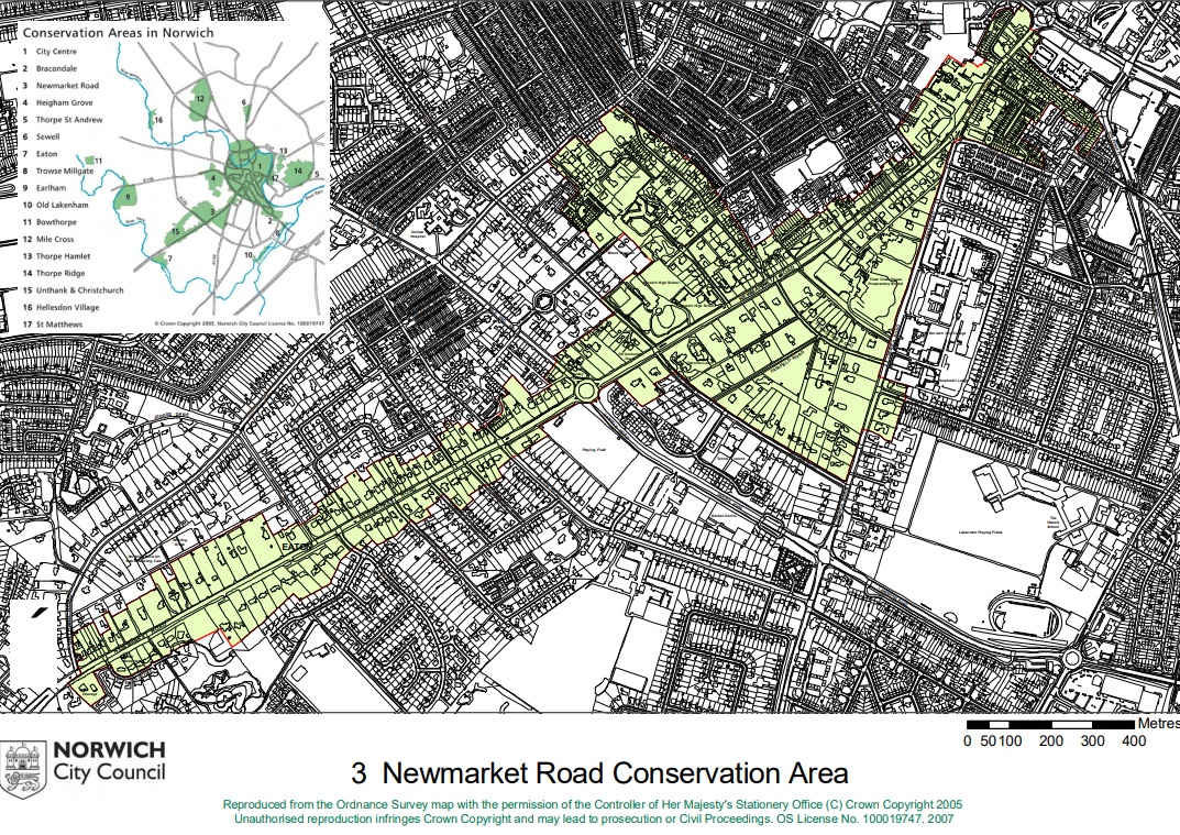
The map below shows the full extent of the Newmarket Road Conservation Area, with the Town Close Road area positioned close to the very centre of the triangle that makes up its north-easterly component. The Newmarket Road Conservation Area was created in 1970 around the Town Close triangle, and was subsequently extended (in 1973, then in 1983, then again in 1992 and finally in 2003) down Newmarket Road, across towards Unthank Road and finally towards St Stephen’s Gate to incorporate the old Norwich Hospital buildings. Norwich City Council are in the process of carrying out formal Reviews of the Norwich Conservation Areas, starting from the original ones of City Centre, Bracondale and the Newmarket Road Conservation Areas. Our Conservation area is currently next in line for review.
Among the successes of Norwich’s Conservation Areas has been in protecting historic trees. In our area three TPOs were placed on historic trees by the City Council when developers made proposals to remove them.